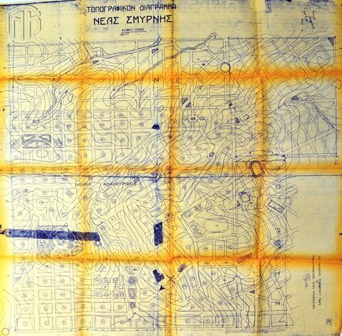
Item 121 - «Τοπογραφικόν Διάγραμμα Νέας Σμύρνης»

Open original Digital object

Identity area

Reference code

GRGSA-CSA ADM372.02-121

Title

«Τοπογραφικόν Διάγραμμα Νέας Σμύρνης»

Date(s)

  • 6 Νοεμβρίου 1929 (Creation)

Level of description

Item

Extent and medium

1 ψηφιοποιημένο σχεδιάγραμμα

Context area

Archival history

Immediate source of acquisition or transfer

Content and structure area

Scope and content

Τοπογραφικό διάγραμμα του συνοικισμού της Νέας Σμύρνης, όπου διακρίνονται οι τοποθεσίες της παλαιάς και της νέας απαλλοτρίωσης.

Appraisal, destruction and scheduling

Accruals

System of arrangement

Conditions of access and use area

Conditions governing access

Conditions governing reproduction

Language of material

Script of material

Language and script notes

Physical characteristics and technical requirements

Finding aids

Allied materials area

Existence and location of originals

Existence and location of copies

Related units of description

Related descriptions

Notes area

Alternative identifier(s)

Access points

Name access points

Description control area

Description identifier

Institution identifier

Rules and/or conventions used

Status

Level of detail

Dates of creation revision deletion

Language(s)

Script(s)

Sources

Digital object (Master) rights area

Digital object (Reference) rights area

Digital object (Thumbnail) rights area

Accession area